In this adventure we will go one more island north than we've been in the past adventures and this time we brought my good friend Basil Mykytiuk with us. Basil is a member of our church and was on a trip with us several years ago to Israel and the Holyland. He's also my partner in a joint venture to develop a charger for our boat, or anyone else's, that needs to charge their batteries at very high rates (e.g., 50 to 200 amps) at a constant current or constant voltage from several different charging sources. Also on this Adventure were my son Jay and our red nosed pitbull Séamus. Basil declined the offer to drive the length of Baja with us so he flew down and Basil's wife Joyce, after reading our other blogs, declined the opportunity to go on an adventure with us at all. As you will see later it was fortuitous that Basil decided to fly instead of ride with us.
 It was bright and sunny the 15th of March when we headed south and we had done a lot of preventive maintenance on our truck in the hopes of avoiding any additional maintenance issues on the way down. We didn't need to stop in San Diego to get repair parts this time so we blew through customs at the border without any delays because we were pretty familiar with the process from our previous two trips. Approaching Ensenada just before noon we saw this big statue of Jesus up on the hill and we took that to be a blessing for our trip. Good, I thought to
 myself, after sitting beside the road for a couple of days on a previous trip, I could use all the help we could get. For any of you who have been through Ensenada, you'll know it's a jumble getting through town. The four-lane tollway ends north of town and then it's everyone for himself through a very large city. I thought it was interesting to see this guy driving his horse and buggy through town without any worries about the heavy traffic all around him. Once we finally got through Ensenada we figured it was time for lunch so we found this turnout and pulled over to give Séamus a potty break and to get lunches for ourselves. While we were sitting there, we saw this man flying over on his powered paraglider.
 He made several passes and seemed to be having a very good time. I think he landed down on the beach, but I didn't actually see him land so I'm not sure. After lunch we continued south until we needed another break and then found a
dirt road leading down to the beach. It was rocky but beautiful there


 dust storms I've
ever seen.
The winds were over 50 mph and at times we could only see a few feet in front of the truck. I had to stop right in the road several times until it cleared enough that we could proceed at 15 mph or so. Here are a few pictures of what it looked like in the sand storm. At one point we came upon this terrible accident between two 18-wheelers. One was carrying bottled

 water and the other had a load of cinderblocks. It looked like they collided in a glancing blow that ripped the truck carrying bottled water open and broke the tie downs for the truck with the cinderblocks. Both products were all over the road and five or six cars were trying to find their way through the debris. I stopped

 long enough to get out and take these pictures, but the truck drivers and some of the other folks standing around were waving their hands at me and I think telling me that taking pictures wasn't allowed. It took us several hours to get through this dust storm and everything on or inside the truck including us was covered in sand and dust. Even when visibility cleared enough that we could
 get up to 50 mph or so, we could see the sand blowing along the highway at the same speed we were going. I wish I had taken a movie of it so you could see how it looked, but I didn't. We arrived late on the night of the 16th and were glad to be in our beds on the boat. We were also grateful that the boat was still there and didn't get blown away or damaged by the horrific winds. There was evidence all around that the sands had blown all the way down to
La Paz because our boat was covered with dust. The next morning,
 17 March we were pleased to see
that our old friend Moses, was at the dock to help us in making some repairs to reinforce the corners around the rear windows of the bridge deck. They had developed cracks as you can see to the left, probably from all of the flexing during the past 5000 miles of
 sailing. Alwoplast, at no cost to me, sent me some small carbon fiber discs to epoxy around the corners of the windows to reinforce those areas. Moses and his assistant Pepi (see next photo down) cut the discs to fit, epoxied
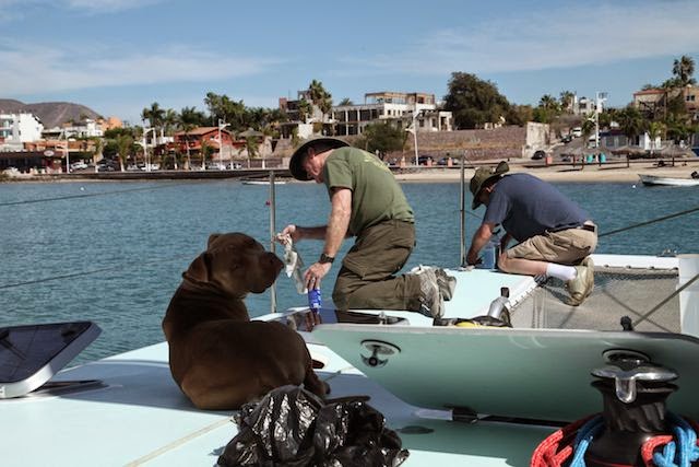
 them in place and sanded the edges down so it was a smooth transition from to the back wall of the pilot house. Fortunately, we still had some of the Alex Seal paint from our last repairs and Moses and Pepi did an excellent job in making the repairs. On the morning of the 18th, I installed the new RI10 device from Navico which is the small box that takes the signal from our Simrad 4G Broadband Radar and links it to our NMEA 2000 network so I can display the radar signal on our chart plotter (i.e., my Apple computer). Since our lightening strike in Valdivia, Chile we hadn't been able to put our radar on the same NMEA 2000 backbone as our wind and depth sensors. They both worked, but not together on the same network. We had hypothesized for some time that the cause might be the RI10 that, although it worked, it might have sustained some damage from the strike. It only took about ten minutes to put the new RI10 in and voila, all of the instruments started working perfectly together. Now I just needed to rewire the two backbones together and reconfigure the wires so it didn't look like a spiderweb and resembled a neat wiring harness.
 As soon as I got it all rewired, Jay and I decided to run a complete test of the instruments, radar, radios, etc. We turned everything on, but much to our chagrin, the VHF radio wasn't working. It wasn't even coming on—no lights, no sound, nothing. A short test with the multimeter showed that it was getting power, it just wasn't working. We sent an e-mail to Brian Gifford, the Tech Rep at Simrad who had helped us before. We got an e-mail from Brian and he said it sounded like the radio was faulty, but that it was under warrantee and he would send us another one. We told him Basil was coming the next day and asked if he could send the replacement radio with Basil. Basil called all of the dealers in Southern California that carried this radio and found one in stock in San Pedro. Brian arranged for Basil to pick it up on the way to the airport the next day so Joyce got to drive Basil not just to the airport, but to San Pedro to pick up the radio as well. The next day, I lowered the dinghy into the water, pumped it up and mounted the outboard motor on it. Moses and Pepi continued working on the carbon fiber patches on the back windows, and Jay took Séamus for a swim. Basil arrived with the new radio about noon on the 20th so I picked him up at the airport and within an hour or two, we had the new VHF radio installed and we were ready to sail, except Moses and Pepi still had some sanding and painting to do before we could leave.
After working on the radio, Basil and I got the
 spots as we could from the deck and from all the stainless steel parts on the boat. Once that was done, Basil was dying to try out his new camera so he walked around the dock and got this great shot of a heron getting ready to pounce on some of the fish that stayed by and under the dock. By the time Basil returned to the boat, I had the dinghy ready to go so we could go find his friend Mike Robertson, who was anchored out in the bay at La Paz. His boat is named Del Viento. He and his family have been sailing around on it for several years. Here's a picture of mike's boat and of Basil and Mike on Del Viento.
  Mike's wife was away on travel, I believe to Thailand so he was there with his two girls Eleanor (10) and Frances (8). We invited Mike and his two girls to visit us on Escape which they did later in the day.
 Frances loves animals and she dragged the rest of the family, including Mike, down to the local vet's office to help with spaying and taking care of the local dogs and cats. Both girls had a great time with our dog Séamus and Frances helped Séamus go through his commands (e.g., sit, stay, down, come, etc.) We asked Mike to keep an eye on our boat
 when we were away because he comes to the docks just about every day. They have visited many of the places we went to see in the Sea of Cortez plus some places farther north than we were able to go. After Mike and his girls left, Basil was treated to the awesome sunset to
 the right. The next morning we were still waiting on Moses and Pepi to finish the work on the back window reinforcements so we took a walk along the Malecón. We saw this sailboat laying on its side
near the municipal dock. It appeared to me that it had come loose from it's anchorage during the fierce windstorm that accompanied the dust storm Jay and I had driven through. I was surprised that no one came to tow it back into deeper water or bail it out. It stayed there the whole time we were in La Paz on
 this trip. There are many statues and pieces of art along the malecón but this old man dreaming of going to sea in his homemade boat is one of my absolute favorites. His dream isn't that different from ours, we just
 have a bigger boat. When we returned to the boat we saw these tents being set up with hundreds of bikes and their riders going through a registration process. It turns out they were getting ready for an Ironman competition on the 23rd starting with a swim right there in front of our boat. I would have liked to have seen it, but we wanted to get sailing as soon as we could and Moses and Pepi were almost finished with the sanding and painting. I decided to go on a standup paddle board (SUP) ride with Séamus while Basil and Jay hoisted a couple of local
 beers. This place is only about 50 meters from our boat so it's a good place to hoist a few.
 By the morning of the 22nd, Escape was all ready to go (see below) so we left Marina Cortez around 0830. Basil was excited so he took a movie of us leaving the docks. You can see his movie on YouTube at http://youtu.be/JpO9XjdulJc. I put Basil to work at the helm to steer us out of the channel while Jay stowed the fenders and dock lines and I plotted a course to San Francisco Island, which was about 38 nm from the exit of the La Paz Channel. The winds were very light, from the aft quarter to begin with so we were
 able to sail with the screecher for a couple of hours (see photo at right). Basil soon tired or steering so we told him about the auto pilot and let him retire to the trampoline for a nap. The winds kept changing on us and moved more and more around to the front so we had to start tacking back and forth to make headway toward Isla San Francisco. Eventually we motor sailed on in to the bay after the winds died on us.
  We arrived at Isla San Francisco around 1500, anchored in about 12 feet of water inside the very picturesque bay and went ashore. Basil and I went ashore in the dinghy to go hiking on the
 ridge above the bay while Jay and Séamus went ashore on the SUP. As soon as Séamus
 could reach the bottom, or thought he could, he jumped off the SUP and ran ashore. We found this great big stick and threw it out in the water as far as we could for Séamus to retrieve. We did that for a while until Séamus tired of the game and then Basil and I headed out on our hike. It wasn't long until we were joined by Séamus who had left Jay down
 When we got down off of the ridge above the bay we were pleasantly surprised to see Jay talking to Katie and Tom
Avery who we had met a few days earlier in La Paz. We chatted on the beach for a while and then they headed off to their boat in their kayak. That night we were treated to a fantastic red sunset and glassy seas—just what we needed for a good night's rest.
 We set off the next morning, 23 March, for Puerto Los Gatos which was about 34 nm north. There were only 5 to 8 knots of wind as we left the bay, but as soon as we got outside the bay, we had 20 knot winds and soon 24 knot winds. Unfortunately, they were from the direction we needed to sail so we had to tack back and forth, but we were going about 8.1 knots and making decent progress towards Puerto Los Gatos. The winds died down around noon so we ended up motor sailing again and got to Los Gatos around 1600. Los Gatos is known for its red sandstone cliff formations as you can see beyond Escape in the photo to the right. It's a nice protected bay as you can see from the photo below and as soon as we dropped the anchor we headed ashore to explore. Basil, Séamus, and I headed up the sandstone formations to explore while Jay took
 the SUP along the shore to see if he could spear a fish for supper.
  Here's a picture of Basil hiking up the sandstone slope and a formation I found that looks a lot like natural stairs. After we hiked around the sandstone formations for a while, we went down to the shore to

explore the tide pools. Here are a couple of shots of Basil and Séamus exploring the
 tide pools. I took a movie of Séamus as he checked things out. You can see it at http://youtu.be/8sl9veIYuPk. At one point he found this lobster
 tail. I managed to get it from him after some coaxing, but it looked like it had been dead for a while so I gave it back to him. Around the corner we saw this crane sitting on a big bolder. I think he was looking for the same school of fish that Jay was looking for. Later I saw this strange star shaped patterns in the sand (right) and this huge star fish
 with more legs than any starfish I've ever seen. On the way
 back we came upon this huge pool of sea urchins. There were hundreds of them in the pool. About that time Séamus came thundering up and ran right through the big pool of sea urchins. I was afraid I was going to spend the rest of the night picking sea urchin spines out of his feet, but he didn't have one spine stuck in his paws. I'm not sure how he did that but I was really happy that he didn't get any spines in him. Jay didn't get a fish, but one of the local fisherman came by as we were getting ready to head back to the boat and sold us a half of a fish. Jay made sushi with it and I cut up the Papaya we had bought in La Paz so we had a good feast before bed time.
 We woke up to a beautiful sunrise at Los Gatos (below left) and departed around 0715 on the 24th.
We headed north toward Loreto. There was almost no wind when we left Los Gatos
 so we started out motoring. Eventually we did pick up 5 to 7 knots of wind, but right on our nose so in order to use the sails we had to go so far off course that it wasn't useful so we put the sails back down and motored. Around noon we caught a pretty big fish from the feel of it, but I forgot to cut the
  motors to slow down and I applied the brake on the fishing reel too fast and too soon, so we lost the fish and our lure. We restrung the fishing line and redeployed it.
  It was 48 nm from Los Gatos to Loreto and Loreto doesn't have a protected harbor so we decided to anchor at Puerto Ballandra on Isla Carmen directly across the bay from Loreto and then sail over to Loreto tomorrow morning. We motored the rest of the day except for about the last hour when the winds came up to about 6 knots, still from the North but we could at least motor sail. Since we were motoring slowly we put up the awning over the forward cockpit so we could stay out of the sun a little and it was a really pleasant sail close to shore near the off lying islands. In the picture at right we're passing by the southern part of Isla Danzante.
 Puerto Ballandra was a really pleasant surprise. Like most of the other bays in these islands in the Sea of Cortez, from a distance you would swear there is no opening at all and then as you get near, you see a narrow opening several hundred yards wide and then when you get through it opens up
 protected bay with ridges all around. Because Escape only draws 3.5' of draught we can usually get farther into the bays than most boats and anchor in shallow water nearer to shore. Left you see Escape in Puerto Ballandra only a couple hundred feet from the trail head. Basil and I went ashore to check out the trails and get a view from the high ground. Most of these islands are volcanic in origin and the trails are usually no more than faint game trails so you end up hiking on pumice rock that's like a giant belt sander if you fall on it. It's scenic though and I always
  enjoy the hikes after sailing all day. It feels a lot more like an adventure if you get to go ashore to explore and sometimes you find some really neat things or critters. After a couple hours ashore, we headed back to the boat and another great supper by Jay and this sunset. We weren't in a hurry to
 depart Puerto Ballandra on
the morning of the 25th because the main mission in Loreto was to visit the mission and the museum there didn't open until
 sometime in the afternoon. While we were finishing breakfast we saw this buzzard and some of his friends trying to warm up by stretching out their wings to absorb more heat from the sun. I
  had seen this in other parts of Baja too, but never was able to get a picture of it. We were just getting ready to hoist the anchor when we saw the dinghy from the boat anchored near us pull up. It was the Canadian couple we had met the day before and they brought us some information we had asked for regarding how to download local weather forecasts over the SSB. We departed Puerto Ballandra around 0930 and motor sailed on a broad reach towards Loreto straight across the bay. As we approached we could make out the silhouette of Missión Nuestra Señora de Loreto so we oriented on that as we crossed the bay. Around noon we anchored a couple hundred yards away from the dock at Loreto and took the
  dinghy ashore. Basil and I visited the Mission Museum while Jay did some grocery shopping with Séamus. The mission was built by Jesuit
  padre Juan Salvatierra and it was from Loreto that Franciscan padres Gaspar Portola and Junipero Serra left in 1769 to explore north reaching San
 Diego and eventually discovering San Francisco Bay. The mission museum is well worth visiting, but since I reported on it extensively in my last blog I am only including a few pictures of it and some of the artifacts here. The whale shark picture at bottom right was at the pier where we had the dinghy tied up. We had wanted to see the whale sharks when we were in La Paz, but we never did so this is about as close to getting a real picture of one as I came. We left Loreto around 1530 and headed south. We initially had good
 a broad reach towards Honeymoon Cove about 13 nm away. About half way to Honeymoon Cove the wind died and we had to motor the rest of the way. We anchored
  in Honeymoon Cove around 1700. It is a very scenic cove, but the shores are steep so we had a hard time finding a good anchor spot. We finally dropped anchor in the south lobe of Honeymoon Cove in 30' of water and let out 150 feet of anchor rode. We went ashore to explore, but didn't have much time before it was starting to get dark so the next morning we stayed at Honeymoon Cove long enough to go ashore again
 and check out some of the trails we located the night before. You can see what a beautiful bay it is and it certainly looks like a romantic enough setting to spend your honeymoon. Honeymoon Cove is on the northwestern corner of Danzante Island and while we were hiking to the top of the ridge on the north side of the island we saw this osprey. It's amazing that he can just land on that cactus and sit there for hours without getting stickers in his feet. After getting back to the boat we were in the process of preparing to depart when we saw a pod of dolphins swim into the bay and start feeding right around the boat. They


 South, the direction we wanted to go so we motored down around Danzante Island. It was a peaceful sail all along Danzante Island and at the southern tip we sailed within 50 to 100 meters of those small islands in the picture to the right. At 1230 the wind increased to around 8 knots, still from the South, but we were able to tack into the wind and maintain 7.5 to 8.5 knots towards Agua Verde
  where we planned to spend the night. It's always a great feeling when you can sail at 8.6 knots with only 8.8 knots of true wind speed (see instruments at left). On the way to Agua Verde we saw a group of sharks attack a sting ray. The ray was about four feet across, but the sharks could just swing it around like a dog with a rag
  doll whipping its wings and tail in the air in an arc. We sailed all the way into Agua Verde Bay under sail power past Roca Solitaria, a giant white granite piller in the middle of the entrance (photo above right and right). The northern lobe of Agua Verde has a narrow entrance, but then opens up to a nice deep well protected bay with fishing huts on the north and west ends. There were seven other boats in the bay besides Escape but we found a good spot in shallow water right next to the fishing huts and the trailhead. Basil and I hiked up on the surrounding ridge lines and walked along the beaches and tide pools. Jay paddle boarded with Seamus and then joined us
 on the hike along the beach. Here are a few of the pictures of the bay at Agua Verde. I think we could have spent several days there just exploring.
We watched Star Trek on the computer after supper. Agua Verde and Puerto Ballandra have to be two of my favorite anchorages that we found


 is a long sandy finger sticking out on the western side of Isla José about 1/3 of the way up from the southern tip of the island and directly across from the delightful fishing village named Evaristo on the east coast of the Baja peninsula. I reported on Evaristo in a previous blog and we had attempted to visit Punta Salinas before, but we could not get ashore because the winds and waves were too
 big. As we cleared Agua Verde and headed south we had very light winds from the rear so we put up the screecher and sailed wing-on-wing (photo left). It was pretty slow going 4-5 knots and sometimes less so we had time to put the fishing line out and rest up a bit. I caught a fish that looked like a baby sword fish (right). It didn't bite the hook, but somehow with 250' of line out, I hooked it in the back. I reeled it in and carefully took the hook out and threw it back in the water. Five minutes later I caught the same fish again, in the same spot on his back. This time he was injured pretty badly so we decided to eat him. After that excitement, I needed a nap so I curled up with Séamus on the trampoline and left Jay and Basil on watch. Séamus is like having a fuzzy portable heater
 on board and it's very comfortable laying with
the fuzzy heater on one side and a pleasant cool sea breeze on the other. After a short nap, I awoke to the smell of these delicious tacos cooking on the grill. Jay had once again done his magic with the grill and we had a
 good feast on our way to the next anchor point. It took all day to sail the 47 miles to Punta Salinas so we arrived after dark around 7 PM. I don't really like sailing into restricted areas at night in the Sea of Cortez because the maps are notoriously inaccurate. I've been in some bays where the electronic maps on our chart plotter said we were sitting on land 700 meters from where we actually were. The paper charts in our cruising guide had proven to be very accurate though and we had sailed into the anchorage at Punta Salinas before so I just stayed out in the
 open water until I reached the Latitude I was sure was far enough south that I would miss the point sticking out and then headed in towards Isla José until I was about at the longitude I needed to be and then turned back north watching the beacon that's out on the point and the depth finder. Once we were within about 12' of water Jay dropped the anchor and we were home for the night. The beacon seemed to be behaving strangely because sometimes it looked like there were several lights a the point and sometimes they even seemed to be moving. The next morning at daylight we could see why. There was a group of kayakers camping
 near the beacon and they were walking around camp with their headlamps on. They came by to say hello as we were getting ready to go ashore. It turns out the leader of the group was from Jackson Hole, Wyoming which is where I was born and raised and we have it painted on the transom of Escape as the home port. Punta Salinas was once a large salt mining operation, but it's now abandoned and takes on the character of an old ghost town from the wild west. There are rusted out old pickup trucks and the parts of a
 bulldozer that I guess couldn't easily be cannibalized and hauled off. It was fun hiking around there imagining how it must have been when people were living there. The buildings were mostly cement or adobe so they would have provided some respite from the heat but still, if you were a kid or teenager growing up in one of the handful of houses there, you would have to ask yourself if there wasn't something more in life than this. Here is a picture of Basil hiking outside one of the houses there and of Jay and Séamus returning from one of the "salt pits". Jay tried to walk down in one of them and immediately sank
 This was real adventuring in my mind. We got to explore an old ghost town and then within an hour
 we were anchored in a new location zipping through the mangroves with Séamus' ears flapping in the breeze on the front of the dinghy or being pulled behind the dinghy on the paddle board with Jay.
 Here's a picture of jay leading the way up one of the narrow passages in the mangroves with Séamus keeping a sharp eye out for fish. In some places it was very narrow with overhanging branches like the one below. This one looks like a big scary hand reaching out for you, but it's really just one of the roots extending out and

 mangroves at Punta Ostiones, we sailed SSW past Isla Coyote and Rocas de la Foca back to our old friend the Isla San Francisco. We pulled into Isla San Francisco around 1230 and to our delight the late Steve Jobs' 280' yacht was anchored there so we took some pictures of it. We could see the captain of Steve's boat looking at us through his binoculars as we came within 50' of his bow and Jay nudged me with his elbow and asked, "Dad do you know what that yacht and Escape have in common?" I couldn't think of anything since I knew that yacht cost about $250M, so I said,
"no, what?" Jay replied, "They were both purchased with Apple Stock." We had a good laugh about that and I thought for a minute that I really wished Steve Jobs would have lived to see his boat finished and that he could have been there at that moment enjoying the beauty of that little picturesque bay at Isla San Francisco. We hiked around some more on the local trails up on the ridgelines and did some snorkeling to scrape a few more barnacles off the bottom of the boat, but mostly we just hung out reflecting on what a great day of exploring we had experienced. At supper we held our beers high and toasted to the U.S. Armed Forces, and to the Ladies. It's tradition to include those two toasts at night on Escape, but that night we also included a toast to Steve Jobs and the technology he developed to enhance our lives.

On the 29th, we departed Isla San Francisco
around 0730 and headed south toward Bahia Gabriel at the southwestern tip of Isla Espírito Santo. The winds were northerly all night and this morning it was blowing around 10 to 14 knots. We attempted to sail up on the anchor with just the mast foils, but could not because the winds were right on the nose so we had to motor up to the anchor. We sailed south toward Isla Espírito Santo at 149˚ M using the screecher and the foresail in a wing-on-wing configuration at 7.5 to 8.2 knots. Here's me and Jay preparing to raise the screecher. At 0930 the winds shifted

more easterly so we had to switch the screecher to starboard, furl the foresail and put the mizzen sail out in the port tack configuration. The TWS died to 7.2 knots but we were still sailing at 5.9 knots with a apparent wind angle (AWA) of 116˚. Around 1100 the winds shifted more easterly so we furled the screecher and put up both jibs in a port tack configuration for a broad reach. We sailed all the way in to Bahia Gabriel under sail and anchored on the south end in 9.5' of water at noon. Here's Séamus keeping an eye out as we sail in to Bahia San Gabriel. We anchored in the SE corner of the bay near this rookery of frigate

 birds. There are thousands of them there. I can't imagine there are enough fish in the whole bay to feed them all. I never see one catch a fish, but they all seem well fed. Basil and I set out on a hike to see if we could make it to the other side of the island. Jay and Séamus went on the SUP, but it wasn't long until Séamus joined me and Basil on the hike.
  The farther we hiked, the thicker the vegetation got and Séamus kept going off in all directions sniffing and investigating. I was afraid we might lose him and eventually the ground was just covered with stickers which seemed to be getting inside my sandals so we aborted the hike and headed back to the boat. That night Jay treated us to a supper of spare ribs as the sun set on our last night of this expedition. What a time we've had. Oh well!
 The next morning, we motor sailed the final 23 miles back to Marina Cortez and were tied up at the dock by about 1230. On the way back, I took the time to "pickle" the water maker which makes fresh water from sea water, so it could be safely stored while we were away for a month or so. It was easier to do that work down in the hull while we were at sea rather than back at the docks where it's hotter. The rest

 significant role in establishing the string of missions to the north so we planned to stop and see it when we drove through Loreto. As we approached we ended up in a long string of cars sitting on the road (left) waiting for this big rock slide to be cleared and then the collapsed bridge a few miles later. Somehow in all the detours, we missed the turnoff that goes to the bigger Mission the Canadians had told us about and it was getting late in the day so we decided not to go back to find the Mission. Someday, though, I'd still like
 to see it. The following pictures were all taken north of Loreto in the vicinity of Mulegé and Bahia Conception. We had hoped to get that far north on this trip, but the first few days we had winds that were blowing directly south when we were trying to go north so we really needed about another week to get to Mulegé and explore that area. Every time we drove by these places on our way north by car, we said to ourselves, "We've got to get up here with the boat and explore this bay and those islands". It looks like a great spot with lots of little fishing villages and many things to see.
 By the time we got to the border and were waiting in line to get through customs, Séamus was exhausted (last photo)—we all were, but we were all excited and were already dreaming about the next adventure ahead. In the next blog, I'll cover the open ocean voyage o bring the boat from La

Paz up to Oxnard, CA. See you all then.


No comments:
Post a Comment