Now that we've repaired Escape's broken mast and have her ship shape again, we're really anxious to start exploring again and we have a wonderful opportunity to do that with the fabulous Channel Islands that lie only about 20 miles off shore. The first island we intend to explore is Santa Cruz which is the biggest and most frequently visited island of the group. I took the following few paragraphs from the National Park Service web site to give you a little history of Santa Cruz and to set the stage for what we might find during our exploration.
According to legend, Santa Cruz Island was named for a priest's staff accidentally left on the island during the Portola expedition of 1769. A Chumash Indian found the cross-tipped stave and returned it to the priest. The Spaniards were so impressed that they called this island of friendly people "La Isla de Santa Cruz," the Island of the Sacred Cross. Today the protection and preservation of Santa Cruz Island is divided between The Nature Conservancy and the National Park Service. The Nature Conservancy owns and manages the western 76 percent of the island, while the eastern 24 percent is owned and managed by the National Park Service.
In its vastness and variety of flora, fauna, and geology, Santa Cruz Island resembles a miniature California. At over 96 square miles in size and the largest island in California, Santa Cruz contains two rugged mountain ranges; the highest peaks on the islands (rising above 2,000 feet); a large central valley/fault system; deep canyons with year-round springs and streams; and 77 miles of craggy coastline cliffs, giant sea caves, pristine tidepools, and expansive beaches. One of the largest and deepest sea caves in the world, Painted Cave, is found on the northwest coastline of Santa Cruz. Named because of its colorful rock types, lichens, and algae, Painted Cave is nearly a quarter mile long and 100 feet wide, with an entrance ceiling of 160 feet and a waterfall over the entrance in the spring.
These varied landforms support more than 600 plant species in 10 different plant communities, from marshes and grasslands to chaparral and pine forests. There are 140 landbird and 11 land mammal species; three amphibian and five reptile species; large colonies of nesting seabirds, breeding seals, and sea lions; and other diverse marine animals and plants. Owing to millions of years of isolation, many distinctive plant and animals species have adapted to the island's unique environment, including the island scrub-jay and eight plant species found only on Santa Cruz and nowhere else in the world.
The island is also rich in cultural history with over 10,000 years of American Indian habitation and over 150 years of European exploration and ranching. Santa Cruz Island, known by the Chumash people as Limuw (translates to "in the sea"), was home to a ten villages that housed over 1,200 people. Many of these islanders mined extensive chert deposits for making tools and produced "shell-bead money," used as a major trade item by tribes throughout California. The largest village on the island as well as on the northern Channel Islands, Swaxil, occupied the area of Scorpion Ranch at the time of Spanish contact (1542). Large plank canoes, called tomols, provided transportation between the islands and mainland. Remnants of Chumash civilization can still be seen in thousands of shell middens on the island.
Remnants of the ranching era also can be seen throughout the landscape of the island. Adobe ranch houses, barns, blacksmith and saddle shops, wineries, and a chapel all attest to the many uses of Santa Cruz in the 1800s and 1900s.
The National Park Service, along with The Nature Conservancy, has made great efforts to preserve and protect these island resources, including stabilization of cultural sites, rehabilitation of historic buildings, removal of nonnative plants and animals, the recovery island foxes, reestablishment of bald eagles, and restoration of island wetlands. All of these efforts have made Santa Cruz Island one of the best places to experience the nationally significant natural and cultural heritage of coastal southern California.
Our first voyage to Santa Cruz was a discovery voyage to take a quick look at all of the anchorages and to gather information to plan more detailed voyages in the near future. Here's a picture of Santa Cruz showing most of the anchorages that we intend to take a look at.

The island is about 19.7 miles long and 6 miles wide and the eastern-most end is about 16.5 nm SW of the Channel Islands Marina where Escape is docked. So, when the winds are perfect, we can sail to Santa Cruz in a couple hours, if they're not, it can take up to 5 hours just to get to the eastern tip of Santa Cruz plus two or three more hours to get to one of the anchorages. If the winds don't cooperate or there are no winds, we can motor or motor-sail to Santa Cruz in about three hours. We much prefer to sail because after all, Escape is a sailboat and it's so much more peaceful—not to mention cheaper—when you're sailing and not motoring. There's also something mystical about sailing versus motoring. When I hoist the sails and feel that tug of power from the wind and then shut down the engines, I always have that boyhood feeling that I'm getting away with something. That, although Mother Nature has rules you have to abide by, if you have the knowledge and the right equipment, you can use some of her own rules against her and get propulsion for free. Of course, it's never quite free and as any sailor who has been at it for a long time will tell you, getting from point A to point B in a sailboat is seldom done in a straight line. Often you have to zig-zag back and forth to take advantage of the wind and still end up where you want to go. Sometimes that takes patience and after twenty years as an Army Ranger and 26 years as a program manager, patience isn't something
that comes easily for me, but I'm getting the hang of it. In our first voyage to explore Santa Cruz, we left the harbor around 1130 on 20 October and initially sailed NW along the coast @ 300˚ towards Ventura and Santa Barbara because the winds were directly from the islands so we had to tack back and forth to get to Santa Cruz. We also ran the port engine at 2100 rpm to give us a little boost and this allowed us to sail closer into the wind than we could with just sail power alone. With the port engine and the sails up we were going at a leisurely 5.2 knots. Jay made sloppy joes for lunch. They were delicious. The winds picked up to over 30
 knots when we were still about 8 nm from Prisoner's Harbor on the north side of the island blowing directly from where we wanted to go so we tacked back and forth with the port engine still running at 2500 rpm. We were maintaining 4.5 to 7.5 knots most of the way to Prisoner's Harbor. We pulled in to Prisoner's Harbor about 1730 and anchored in 17' of water. It was a real pleasure to get into the protection of Prisoner's Harbor and get out of the high winds and growing waves for the night. There was only one other boat in the harbor and it was already getting dark when we dropped the hook (see pic
 at right). On the way out from the marina, we passed Oil Platform Gail shown in the picture to the right. There are two of them in the channel between Oxnard and the Channel Islands and they are quite useful for checking your navigation instruments because they show up good on your radar and at night they're always lit up so you can see them for many miles. I had made the decision to go around Santa Cruz counter clockwise and take a look at each of the harbors or bays on our first trip. The idea was to take the NW winds head on during the first part
 of the trip and have them at our backs during
 the sail along the southern shore of Santa Cruz. In retrospect, I probably should have done it in reverse because the winds on the north side of the island are stronger and we would have been better off sailing into the winds along the southern shore after they had been weakened by the island. That's one reason I like listening to the "Old Salts", guys who have been sailing many years, because you can learn these things just by listening rather than by beating yourself to death sailing into the wind and waves all day. We had breakfast from 0730 to 0900 on the morning of the 21st, pumped up the dinghy to make sure it was ready to go ashore if we got the chance, washed the
that comes easily for me, but I'm getting the hang of it. In our first voyage to explore Santa Cruz, we left the harbor around 1130 on 20 October and initially sailed NW along the coast @ 300˚ towards Ventura and Santa Barbara because the winds were directly from the islands so we had to tack back and forth to get to Santa Cruz. We also ran the port engine at 2100 rpm to give us a little boost and this allowed us to sail closer into the wind than we could with just sail power alone. With the port engine and the sails up we were going at a leisurely 5.2 knots. Jay made sloppy joes for lunch. They were delicious. The winds picked up to over 30
 knots when we were still about 8 nm from Prisoner's Harbor on the north side of the island blowing directly from where we wanted to go so we tacked back and forth with the port engine still running at 2500 rpm. We were maintaining 4.5 to 7.5 knots most of the way to Prisoner's Harbor. We pulled in to Prisoner's Harbor about 1730 and anchored in 17' of water. It was a real pleasure to get into the protection of Prisoner's Harbor and get out of the high winds and growing waves for the night. There was only one other boat in the harbor and it was already getting dark when we dropped the hook (see pic
  at right). On the way out from the marina, we passed Oil Platform Gail shown in the picture to the right. There are two of them in the channel between Oxnard and the Channel Islands and they are quite useful for checking your navigation instruments because they show up good on your radar and at night they're always lit up so you can see them for many miles. I had made the decision to go around Santa Cruz counter clockwise and take a look at each of the harbors or bays on our first trip. The idea was to take the NW winds head on during the first part
  the sail along the southern shore of Santa Cruz. In retrospect, I probably should have done it in reverse because the winds on the north side of the island are stronger and we would have been better off sailing into the winds along the southern shore after they had been weakened by the island. That's one reason I like listening to the "Old Salts", guys who have been sailing many years, because you can learn these things just by listening rather than by beating yourself to death sailing into the wind and waves all day. We had breakfast from 0730 to 0900 on the morning of the 21st, pumped up the dinghy to make sure it was ready to go ashore if we got the chance, washed the
  windows, checked oil etc. and headed out to explore Pelicans Bay 1.2 nm NW around 0930 (see pic above right). There was no wind when we started out, but that changed as soon as we got out of the protection of Prisoner's Harbor. The wind was right on our nose as we headed to Pelican Bay and the 4 to 5 foot closely spaced waves made it a bumpy ride. Here's what Pelican Bay looks like from about half a mile out (above right). The anchorage is on the right side of the picture and what appears to be a good anchorage on the left side of the picture is OK for landing your dinghy, but not for anchoring a big sailboat. Jay and I had some previous experience with Pelican Bay because in 2011, Elaine won a couple tickets on Island
 Packers out to Prisoner's Harbor in a raffle and sent me and Jay to check it out. We hiked the trail from Prisoner's to Pelican Bay so we were at least familiar with those two anchorages. On that previous trip we encountered a pod of dolphins with probably over a thousand dolphins in it. I got this shot of them, but it's harder than you might think to capture them out of the water because (a) you don't know where they're coming up next, (b) they're not out of the water very long, and (c) they're moving really fast. There is a long dock at Prisoner's Harbor (see below right), but you're not allowed to tie up to
 it. You have to anchor on the other side of it from where this
 picture was taken. On shore there are some old farm houses and buildings that were very interesting to see and there are some old relics of farm machinery, saw blades from a lumber mill, etc. There are also some endemic species on the islands including some foxes and this scrub blue jay. I didn't see any of the foxes while we were on our hike from Prisoner's to
  Pelican Bay, but I did get some good pictures of the Scrub Jay. Maybe on one of our hikes on Santa Cruz, we'll get to see the foxes. At right is a picture of Pelican Bay as it appears from the trail from Prisoner's Harbor to Pelican Bay. On this current excursion to Santa Cruz, we pulled in to Pelican Bay and circled around it, but did not anchor because we wanted to look at other anchorages and Pelican didn't offer much protection from the wind and waves that we were experiencing on 21 October 2014. On our way to Fry's Harbor which was the next anchorage we wanted to check out, I observed a huge billowing of mist coming from the shore. At first I thought it might be a whale, but when I looked at it through the binoculars, I could see that it was just a blow hole. A blow hole is a cave that goes back into a cliff that waves can go into, but as the wave goes in, it traps air in the cave and forces it and spray out through a hole in the top of the cave. You can see a movie of the blow hole at
  http://youtu.be/3R9x3ERZzwY. Fry's Harbor at right looked like a very good anchorage with pretty good protection from winds and waves from the west or south and southeast. It looked big enough for two or three boats if everyone used a bow and stern anchor to keep their boats pointed in the same direction. It would probably
 be fine with just a bow anchor if we were the only boat in the anchorage. We didn't drop the hook in Fry's Harbor, but headed westward on to Lady's Harbor (see pic at right). We didn't go into Lady's because of the waves. It looked small for our boat, but several other captains from our marina swear you can get several boats in there. Maybe we'll give it a go the next time we get out to Santa Cruz when the winds are from the east or south. Farther west, Cueva Valdez was bigger and looked like we could easily get Escape into it, but it did not offer protection from the NW winds we were experiencing that day. The winds weren't really high, maybe 15 to 20 knots, and the waves were only 4 or 5 feet high, but spaced fairly close together so the ride was bouncy. Here's a video of how it looked as we neared the northwest corner of Santa Cruz and prepared to turn south between Santa Cruz and Santa Rosa Islands. http://youtu.be/Nvg9HLIuW58. Once we made the turn, we could shut down the engines and proceed on sail power alone. Between the islands we had about 15 knots of westerly wind and large swells, maybe 15 feet high but spaced far apart so it was really easy going. We were going 7 knots with just the foresail and the mast foils. We didn't attempt any of the potential anchorages along the western end of Santa Cruz because our cruiser's guide said they were sketchy in calm conditions and we could see the giant swells slamming into the cliffs and going over 30' up the sides of the cliff. We turned east and started sailing along the south side of Santa Cruz around
  1410 hours with 26 knots of true wind speed (TWS) from the port stern quarter. We were cruising very comfortably between 7.5 and 9 knots with both sails out on the starboard side but with the mizzen sail reefed in to the second reef. We passed by Willow's Harbor (see pic at right) and it appeared to have a good beach and looked like it had adequate space to anchor Escape but we did not anchor there. We anchored at Coches Prietos Anchorage about 1530 in 14 feet of water. The bay was filled with lobster pots and we were the only ones in the cove until another boat that we had seen at Willows joined us about
  an hour after our arrival. This is a great spot with a nice beach and a trail leading up the hill away from the beach. Here's a video showing the whole bay from our anchor spot: http://youtu.be/VsbVf6iEKEo. Jay immediately hopped in the water for a swim and I lowered the dinghy for a look around. There are lots of tide pools to explore when the tide is out and just around the corner from Coches Prietos is Albert's Cove that looks like a pretty good anchorage too if the wind is from the north or northwest. I wanted to go up the trail that led into the mountains or follow one of the trails that went up to the cliffs overlooking the bay, but

every time I headed off to explore, when I looked back my dinghy was washing out to sea. Clearly I need to get a different anchor than the grappling hook anchor I have for the dinghy and I need to devise a different method of anchoring the dinghy so I can anchor it out beyond where the waves break, but so I can retrieve it when I

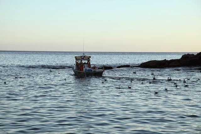
come back from exploring. Once we got back on the boat, Jay made this fantastic bacon-wrapped hamburger, which we enjoyed with a beer while we watched the lobster/crab fishermen come in to retrieve their traps that were all over the bay making it impossible to anchor in some spots. Here is a video of the fishermen checking out their lobster pots and the huge gathering of sea birds waiting for a handout: http://youtu.be/-CLvfBYZdQk.
 On the 22nd we swam around and checked out the bottom of the boat. The water was very clear and there were many schools of fish swimming around the boat. We departed Coches Prietos around 1130 to head back to our marina. Unfortunately, the winds shifted Easterly as soon as we came out of the bay so we had to motor sail along the southern side of Santa Cruz. At 1350 we turned on our last leg toward Oxnard on an azimuth of 47˚ M. The wind was coming from 290˚ so we were on a broad reach with the wind slightly behind our port beam at 7 knots and we were sailing at 5 knots. One of the goals for this trip was to test the spinnaker which we hadn't had up since we installed the new front mast which required us to have about 4' trimmed off the spinnaker. With about 9" of line from the
  bowsprit and the spinnaker halyard tight, we still had about a foot of halyard before the pulley at the top of the mast so the fit was good and the shape of the spinnaker was excellent. With 11.6 knots of TWS we were going 7.1 knots with the spinnaker and mizzen sail up. On the way back we saw this herd of sea lions and this pelican flying along beside the boat. We arrived back at Anacapa Isle Marina at 1700. In our next adventure, we hope to explore more of the anchorages on Santa Cruz and some of the trails and caves that abound on the island.