My oldest son Jack, who lives and works down in Orange County here in Southern California has been trying to participate in one of our adventures out to Santa Cruz Island for quite a while now and we finally were able to get our schedules to match on 9 and 10 April 2015. We had planned to go the week before, but the weather was not good and although we probably could have sailed there, the wind and waves would have been such that it would be difficult to get ashore. In addition, we were looking for weather conditions that would be conducive to anchoring on the north side of the island since we have anchored at most of the good anchorages on the south side. So with favorable winds forecast for 9 and 10 April, Jack and his friend Chris Chavira came up the night before so we could get an early start on the 9th. We slept on the boat that night so we all pretended we were in a harbor in some exotic place and watched the lights around the harbor and the boats go up and down the channel. Jack and Chris didn't get to the marina until almost 11 PM so Elaine, Jay, Heather, Séamus (our dog) and I were ready to hit the sack when they finally arrived.

 By 0730 the next morning we had checked all the instruments, made sure the radar was working, and warmed up the engines so we eased Escape away from the dock and headed out to sea. I let Jack steer the boat out of the channel so I could divert my attention to getting the sails up. Chris helped us get the fenders up on deck and kept an eye out for traffic as we approached the breakwater and the open sea. The winds were light around 6 knots so we motor sailed towards Santa Cruz. With the port engine running at 2400 rpm and the sails up we were going about 4.5 knots on reasonably glassy seas.
 Once the sails were up and everything seemed to be under control, Jay started breakfast with bacon, eggs, coffee, and toast. Chris added moral support through the back window (right).
As Jay was preparing breakfast I was on watch on the front deck because there is a big shipping lane that runs between the Channel Islands and the California coast. I could see a very large container ship approaching us and the compass heading to that tanker was staying pretty constant as we closed with it and that means we were on a collision course. I went inside to check the chart
 plotter and sure enough the Automatic Information System (AIS) symbol for that ship was blinking red which means it's on a collision course with us. I reached over and punched in a couple of degrees to port on the autopilot so that we would go slightly behind the big ship. At the closest distance we got to the container ship I figured we were within 200 meters of it. I later blew the picture of that ship up and calculated that it was carrying over 1000 shipping containers and the AIS indicated it was going over 17 knots. In the daytime those big ships are pretty easy to spot unless it's foggy, but at night
https://youtu.be/cSuAUpWyhOw. I'm not sure why you can't just click on these links, but if you cut and paste them into your browser, they will play for you and they're really fun to
 watch. These dolphins stayed with us for quite a while and seemed to be really enjoying themselves. Elaine was convinced that if she sang to them that pods close to the boat would come over to investigate and would swim with us for a while. Séamus was very excited and ran back and forth on the trampoline whenever the dolphins moved from one side of the boat to the other. About the time the dolphins dissipated for the second time, Jack and Chris told me that they planned on camping out on the island and doing some hiking. This was new news to me and required some quick rethinking of the plan I had
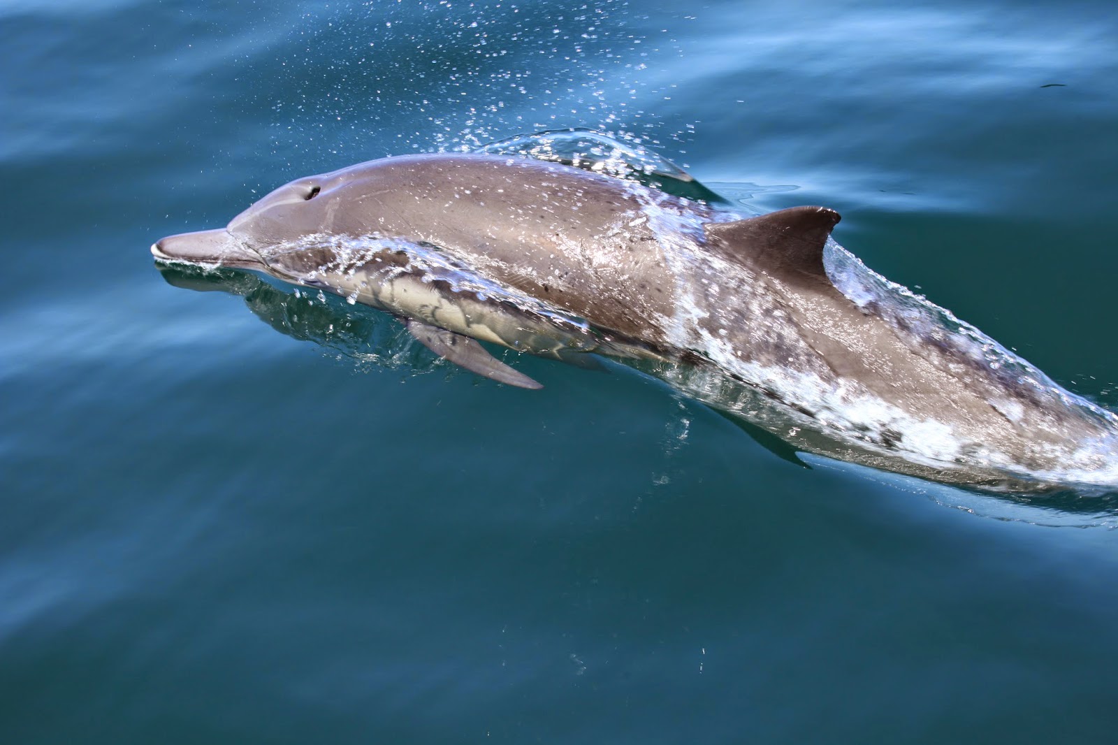
campground
 northeast of Prisoner's Harbor and from my chart plotter on the boat I could see that from Prisoner's Harbor to Smuggler's Cove was about ten miles. Both Jack and Chris said they had hiked that distance several times already on previous camping trips so they were pretty psyched to get dropped off at Prisoner's Harbor
 and hike up over the spine of the island back to the southeastern end to Smuggler's Cove. We considered Potato Harbor and dipped in to Chinese Harbor looking for trails from those
 anchorages up to the trail that traversed the spine
of the island towards the east, thinking
 that if I could drop them off a little closer, they would have less distance to hike. Unfortunately, the charts I have for sailing
 and navigating in the water aren't very useful for land navigation because they don't show any of the trails and no contour
 lines. With our binoculars we didn't see any trails leading up from the beach at either of these two anchorages so we sailed on towards Prisoner's Harbor. We had about an hour and a half before reaching Prisoner's so Elaine and
 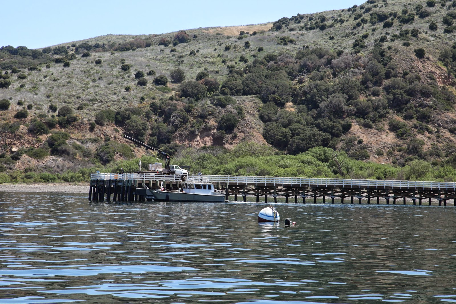 Séamus took up observation positions to keep an eye out for dolphins or whales (above right) and Jack and Chris had another beer and relaxed on the trampoline to prepare for their long hike (see pics above left). We got to Prisoner's Harbor about 1230 (above right) and Jay BBQed some bratwursts (pic at left) so Jack
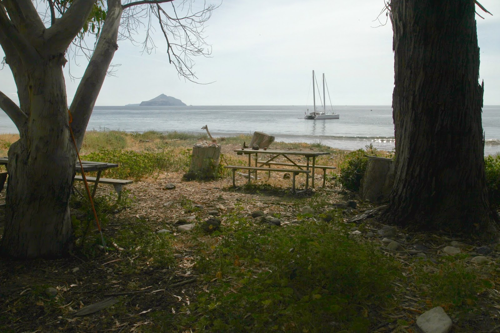
 I dropped Jack and Chris off at Prisoner's Harbor with the dinghy around 1345 so they could start their hike and then sailed/motored over to Pelican Bay about a mile and a half east of Prisoner's. We arrived at Pelican Bay at approximately 1415 and anchored in about 30' of water. The whole bay seemed to be about that deep and we had to let out quite a bit of scope to be sure our anchor would stay dug in. Here's a picture of our anchorage in Pelican Bay (pic at right) and you can see a 360˚ video of the Bay on You Tube at https://www.youtube.com/watch?v=X_Cmbqc6gTY. There were two other boats in the bay so we had to give them some space, but we still had a pretty good spot as you can see. After I was sure our lines were secure I went ashore in my kayak and to hike the trail to Prisoner's Harbor and back. If I'm going ashore alone, the kayak is now my weapon of choice because I can put my hiking boots, clothes, camera gear, and camel back in the water proof compartments and get ashore even with fairly big swells. There's a small cove next to Pelican Bay that is too small to anchor in, but it has a better
  beach to land a dinghy or kayak on (see pic above right) and it has better access to the trail to Prisoner's Harbor. Once I got my hiking boots on, I went up on the bluff between Pelican Bay and the little cove I was in just to be sure Escape was staying put and wasn't drifting towards the rocks. As I hiked up the draw looking for a way to get up on the bluff, I saw this rock wall that clearly was man-made. I'm always amazed that there's such a mix of wilderness and then all of a sudden some old indian paintings or remains of a ranch, or something else. Once I got to the top, I could see Escape sitting peacefully in the Bay
  (see pic at right) so then I walked about 50 feet over to the east side of the bluff overlooking my kayak and took this picture of the north coast of Santa Cruz looking east towards Prisoner's Harbor (below right). While I was up on the
  bluff I saw some wildflowers there so I took out my cell phone app to see if I could identify what
  they were. I believe the one to the left here is a Jimson Weed but it could also be a Morning Glory and the one below is a young Yucca Plant. It's hard to tell for sure because nothing looks exactly like the 10,000 plants in the app, but as time goes on I'll get better at identifying these plants and the critters I find as I wander the islands.
 As I dipped back down in the bay where I left the kayak and headed up the other side to get on the trail towards Prisoner's Harbor, I took one last look back to make sure Escape was secure (see above right) and through my binoculars I could
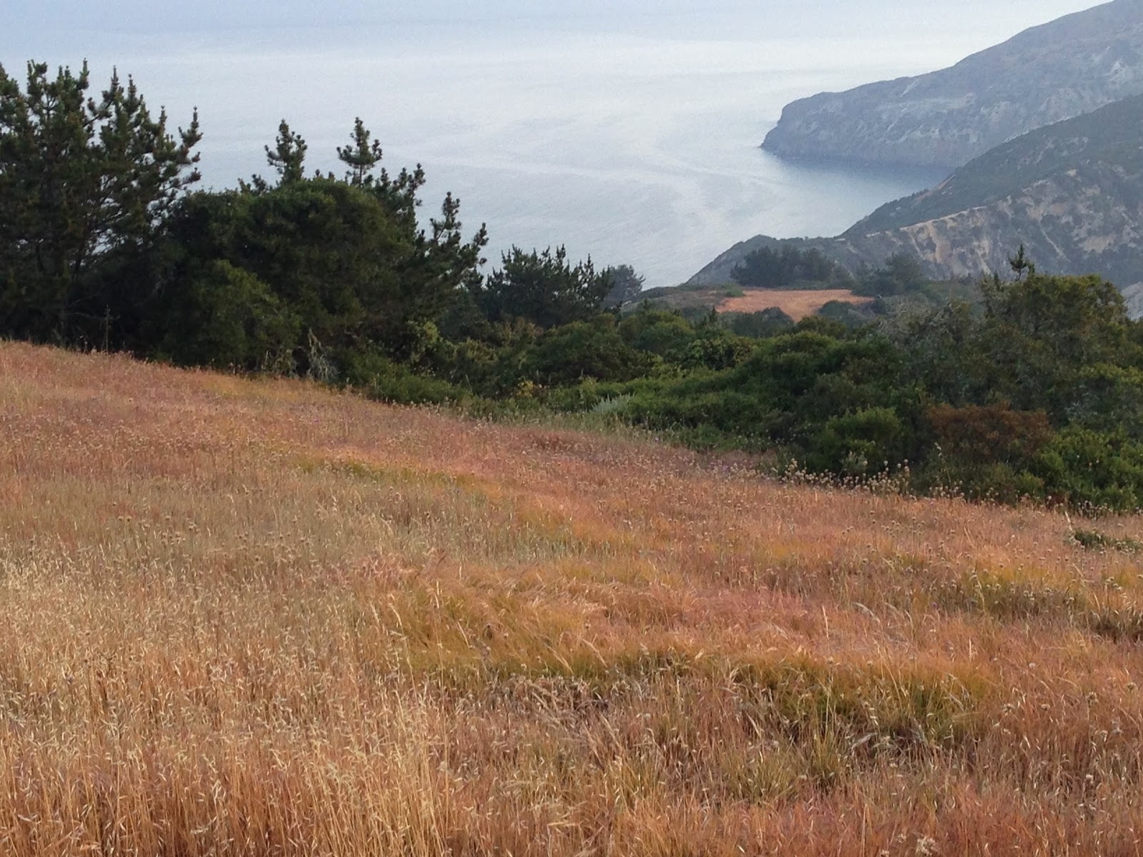
 see Elaine and Heather on the back deck having a good time. I had been on this trail once before although I was going in reverse from how I had hiked it then. This is a very pleasant hike and smells of pine forest. Below left are a couple pictures showing you some vistas along the trail. Most of it is level going along undulating terrain with good views of the ocean, but there are also a few really steep traverses down into ravines and scrambles up the other side. It's certainly best to do this hike with a friend just in case you slip on a rock or root and hurt yourself. These islands are fairly remote so you're pretty much on your
 own out here.
  There was evidence of the pine beetle along the trail as you can see from the picture below right. There are over 2000 plant and animal species on the islands,
 of which 145 are found nowhere else in the world. Along the path I saw this shrub
brush to the left, which I believe is manzanita. You can see that the bark is smooth and red and the wood is very hard and heavy.
While we were on our way to Pelican Bay and I was out hiking, Jack and Chris had met up with a woman who was on the beach where I dropped them off and she pointed them toward the trail entrance to the camp ground at the top of the ridge. It was about 4 miles from where I dropped them off to the campground and about a 900 foot elevation gain. I had given them one of my hand-held VHF radios with a built-in GPS so we could stay in touch, but although they had the GPS, they didn't have a map so they didn't have any way of matching their coordinates with their position on the map. Consequently, they missed the Del Norte Trail which leads to the camp ground and climbed up the road towards the Navy Base at around 1500 feet. Here's a picture of the portion of the map they needed that I took from a couple of hikers I met the next day.


 contact. Around 1130, which is when they thought would be the latest they would get to Smuggler's, I took the kayak ashore with my hiking gear and another hand-held radio and hiked up the trail towards the peak between Smuggler's Cove and Scorpion Anchorage and tried to raise them on the radio. No luck! I waited there for about an hour asking every hiker I saw if they had seen Jack and Chris along the trail but no one had. Finally, I went back down to the boat in case they had diverted to Scorpion or some other landing so as soon as they called, we could hoist the anchor and go get them. In the meantime, Jack and Chris were getting farther off course going south towards the south
 shore which is nothing but steep cliffs and bluffs into the sea.
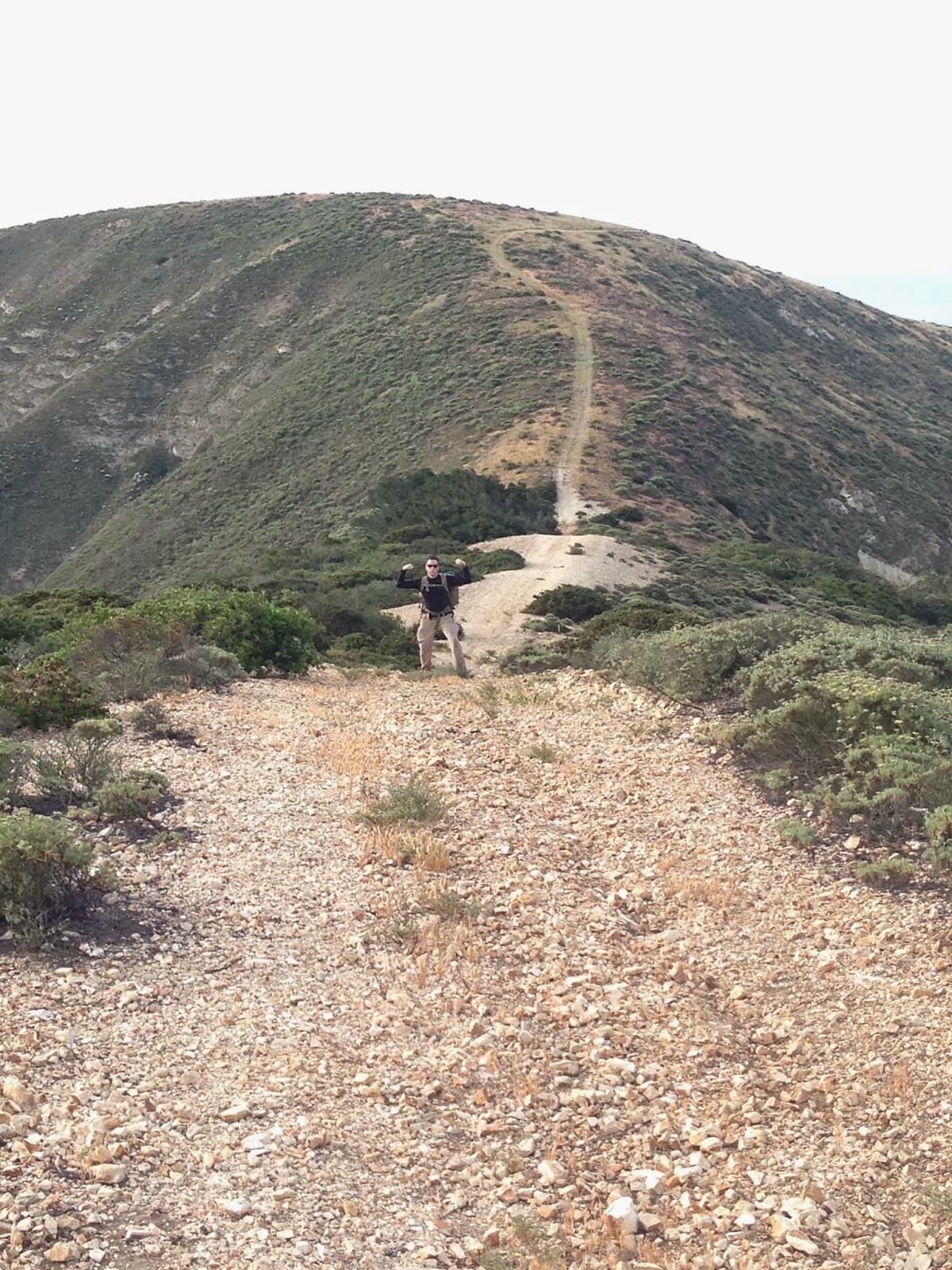
 Two pictures above and right is a picture of the fire road they were hiking on when they left camp and directly above and right is a picture of the trail they took towards the south side of the island.
 Just above is a picture of the trail kind of petering out as they
 got closer to the coast. This should have been a good indicator that they were off the main trail and were about to get lost. By this time, Jack had blisters on his feet and they were running low on water although they still had plenty of food. They knew it was getting close to the time they were supposed to rendezvous with us and they thought that Smuggler's Cove was just down on the coast and maybe a little to the east so they pressed on. To backtrack would have taken a tremendous effort to climb back up to the main road and probably another four or five hours to get to Smugglers Cove. So, they pressed on. Along the way they took this picture of these lupine flowers and eventually arrived at this precipitous drop

to the ocean below. After saying some serious prayers and telling each other how much they loved each other and what a pleasure it had been to be best friends for the past ten years, they started sliding down the incline on their butts and bracing themselves by hanging onto the brush as they went down. It's about a 350' drop on either side of that nose going down to the sea and very crumbly so they were extremely lucky to get to the bottom without serious injury or worse. Once at the bottom, they still couldn't see Escape or Smuggler's Cove so they started hiking along the beach, such as it was until about 45 minutes


later, they could go no farther—blocked by cliffs and the sea. As luck would have it, however,
there was a large boat named Peace just a couple hundred yards off shore that was a commercial dive boat that took scuba divers out for the day. Jack and Chris noticed that the people on board had been watching them through binoculars as they slid down the incline and hiked along the shore so they started waving their arms and yelling to see if anyone would come get them and give them a ride to safety. Immediately, the boat put their dinghy in the water and rescued Jack and Chris off the beach. As I was returning from my own expedition to find the missing hikers, I took this picture (two pictures above and right) of Anacapa
from the top of the bluff at the east end of Santa Cruz Island and this picture of Escape sitting peacefully in Smuggler's Bay waiting for Jack and Chris to arrive. I also saw this great display of sea shells and fantastic hiking stick like Moses would have used to part
the Red Sea. I thought of trying it at least symbolically, but then decided against it and went to check out the old abandoned ranch house up the lane in the picture to the right. The farm house itself is in the picture just below. It isn't active any longer, but has been restored to the way it was when the sheep ranchers used it many years ago. You can't go inside the building, but you can walk all around it. As soon as I had checked out the old ranch house, I hurried back to the beach and put my clothes and camera gear back into the kayak to get back to Escape. The surf had totally thrashed me coming in to the
beach so I was going to try a different technique getting back through the surf. What I did was wade out to about thigh deep water and just waited patiently until the next wave came in, then plopped my kayak down, hopped on it and paddled like crazy to beat the next wave. That worked really well. Just as I was getting back to Escape Jay said that a boat had just called on the VHF radio that they had Jack and Chris on board and that they would be entering Smuggler's Cove in about ten minutes. A couple minutes later, the boat Peace showed up (see above left), turned
around and lowered their dinghy with Jack and Chris and brought them safely over to Escape. You can see a movie of them being delivered back to Escape, with their tails between their legs in shame for having been lost, but very happy to be alive and once again reunited with us. The movie is at: https://www.youtube.com/watch?v=WaeJtkFkpko.
Well that's it for this adventure. We hope to do a lot more of these types of adventures, i.e., sailing, hiking, and exploring, but next time whoever goes ashore will have a good map and compass and know how to use them.