
fast but we were still rocking because of the waves. I
gave him some Dramamine as a prophylactic measure and that seemed to help. Within a half hour, the
wind came back to 20-25 kts, but from the other side of Escape. Consequently, we reefed in the jibs, cut the motors and proceeded towards Prisoner's Harbor at 7-8 kts. About 1630
 we dropped the hook at Prisoners Harbor in the lee of the north side headland. With 50' of chain and 20 ft of line in 15' of water (~2-5 ft tides around here) and a light breeze we were well set to enjoy the sunset, and have a beer and fine meal by Jay of pasta with grilled shrimp and kielbasa. Here's Chaz sitting at the table and out on the back deck taking a few pictures. Both Chaz and I are pretty serious about our photography. I have a Canon EOS 5D Mark II and Chaz has a Nikon 7200 and we both have multiple lenses to get the shots we need. Even though there were 20 - 25 knot winds and pretty decent waves where we had just come from, it was relatively quiet and smooth tucked in behind the high ground north of the pier. It got dark early and we were tired so we hit the sack around 2030 hours , 2330 East Coast time.
We woke up about 0730 on Tuesday, the 22nd of September after a good night's sleep. Chan made omelets for all of us with onions, peppers,
cheddar, and Columbia Nariño coffee with an Aeropress coffee system for semi-expresso
strength wake-up.
After cleanup we weighed anchor and motored ~1.5 miles to
Pelican Bay (see map below)
 and re-anchored so we could take the
dinghy back to Tinkers Cove. At ~0930 we landed on the large pebble beach with Chaz in his reef runners on the bow to handle the wet part of the landing. After setting a small anchor covered with rocks we set out on a 2.5 hour hike between Pelican and Prisoners' - weather was ~70F, light breeze, sunny - Excellent!

 left is a picture of Tinkers Cove from a bit farther away so you can see how it looks. It's not big enough to anchor Escape or another larger boat in, but it's nice for landing the dinghy because it is well protected and there usually aren't any
 big swells coming in to it. Once we got ashore, we climbed up on the ridge between Tinkers Cove and Pelican Bay to get a good look at Escape and to make a final check on the dinghy to make sure it wasn't washing out to sea before we started our hike. Here are a couple pictures of Escape in Pelican Bay. There was only one other boat in the bay so it was easy to anchor there. Chaz wasted no time breaking out his camera and started taking pictures (see insert at right) of the local flora (in this case Yucca Plants) and of the surrounding coastline. The picture below
right is what


 Looking down at Tinker's Bay (left), we could see the dinghy was still in place so we started out on the trail toward Prisoner's Harbor. This trail is mostly along rolling wooded hills with good views of the bay (see above), but there are a few steep rocky descents into ravines like in the picture of Chaz at right and of me below left. Along the trail we came across the
  stone circle
 shown at left that was left as a relic from the times when the island was occupied by the Chumash indians. Once we finally got back aboard Escape
about noon
 Jay told us about an arch he had discovered while we were gone and while he was paddle boarding with Séamus, our dog. The arch was just around the corner to the north of Pelican Bay so Chaz and I motored over there in the dinghy to see it. It was a really cool arch that Jay said we could go through with our dinghy as long as we lifted the motor up because there were rocks that would have been a potential obstacle. Beyond the arch, it opens up into a big bay that we really wanted to go see, but the swells were pretty big and although they weren't breaking, we weren't sure we could paddle the dinghy back out of there against the swells.
  Consequently, we didn't go through the arch, but we will sometime in the future. We weighed anchor from Pelican Bay and motored into a light breeze following the coast as we headed WNW while benefitting from partial abatement of the wind on the nose. Séamus took up his customary watch position (see left) as we sailed along the coast. After we cleared "West
Point" on the western most end of Santa Cruz we headed southwest and set the foils, rolled out both jibs and cut the engines. It's always a relief to me when we can turn the engines off and all you hear is the wind on the sails and the bows slicing through the water. On a close
reach we soon made 6 kts in a light sea. By half way through the 7 nm
journey across the channel separating Santa Cruz and Santa Rosa Islands the
wind backed more behind us and soon we had ~ 75 deg apparent wind with both true and
apparent wind speeds about 20-21 kts, as we closed on Bechers Bay on the NE
coast of Santa Rosa at 8.3 kts. From a previous trip Chan found a small
hook in the coast (see the small hook just SW of the "Y" in the words "Bechers Bay" below) that gave some protection from the NW breeze. As we arrived about 1630 and set the 77 lb Spade anchor with 50 ft of chain & 20
Consequently, we didn't go through the arch, but we will sometime in the future. We weighed anchor from Pelican Bay and motored into a light breeze following the coast as we headed WNW while benefitting from partial abatement of the wind on the nose. Séamus took up his customary watch position (see left) as we sailed along the coast. After we cleared "West
Point" on the western most end of Santa Cruz we headed southwest and set the foils, rolled out both jibs and cut the engines. It's always a relief to me when we can turn the engines off and all you hear is the wind on the sails and the bows slicing through the water. On a close
reach we soon made 6 kts in a light sea. By half way through the 7 nm
journey across the channel separating Santa Cruz and Santa Rosa Islands the
wind backed more behind us and soon we had ~ 75 deg apparent wind with both true and
apparent wind speeds about 20-21 kts, as we closed on Bechers Bay on the NE
coast of Santa Rosa at 8.3 kts. From a previous trip Chan found a small
hook in the coast (see the small hook just SW of the "Y" in the words "Bechers Bay" below) that gave some protection from the NW breeze. As we arrived about 1630 and set the 77 lb Spade anchor with 50 ft of chain & 20 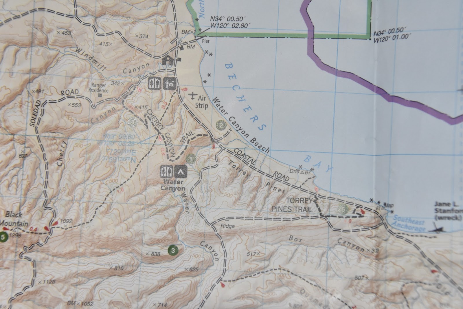

feet of line in 11 to 12 ft at the anchor drop. This was at high tide
with a 1.5 ft range at this location today. Here's a picture of our anchorage with Escape's nose pointed NW towards the small protective hook. You can see a 360˚ video of our anchorage in Bechers Bay at: https://youtu.be/aH5bMlYtvKU. Since Chaz and I had hiked several hours already this morning we did not go ashore on Santa Rosa today, but planned on hiking Cherry Canyon Trail (see map above) tomorrow morning. Jay and Séamus went paddle boarding to explore along the coast and to look for places that we might be able to land the dinghy in the morning. Jay again performed the duties of Master Chef, preparing bacon wrapped sausages on the Magma gas grill on the starboard aft deck, as Seamus sniffed the air hopefully. It was a fantastic meal and we all got some reading in and some discussions about the finer points of sailing. It was my intent to learn as much as I could
 from Chaz about sailing on this trip and he hoped to learn as much as he could about the capabilities of this "first of its design" catamaran with the mast foil sailing rig with two big jibs and no mainsail. Chaz presented me with a gift book titled "Sailing Theory and Practice" by C. A. Marchaj. It's an excellent book and will be kept on board Escape as a reference for interested sailors to read on such nights as tonight.
  The next morning, 23 September, Chan made waffles with a stove top waffle iron - which he
served up with butter, strawberries, maple syrup and whipped cream plus strong
Aero-pressed Columbian coffee and bacon. After breakfast we motored ~1.5 nm along Water Canyon Beach
on the north side of Becher's Bay and re-anchored just north of the Channel Islands
National Park pier. Here is a picture of our anchorage just north of the pier and of Jay and Séamus as we circled Escape on our first attempt to find a place to beach the dinghy without getting swamped. We couldn't find a good spot to land so Jay had to drop us off at the pier as there is no
The next morning, 23 September, Chan made waffles with a stove top waffle iron - which he
served up with butter, strawberries, maple syrup and whipped cream plus strong
Aero-pressed Columbian coffee and bacon. After breakfast we motored ~1.5 nm along Water Canyon Beach
on the north side of Becher's Bay and re-anchored just north of the Channel Islands
National Park pier. Here is a picture of our anchorage just north of the pier and of Jay and Séamus as we circled Escape on our first attempt to find a place to beach the dinghy without getting swamped. We couldn't find a good spot to land so Jay had to drop us off at the pier as there is no 
tie-up accommodation or dinghy dock. As you can see in the picture at left, the pier in Bechers Bay is a significant dock and it's a shame that there is no facility to tie up to it with dinghies because it makes it really difficult to land there. But, with a ship-to-shore radio
we were able to keep in communication and alert Jay of our progress so he could pick us up again at the end of the hike. Just as you get off the pier there are some buildings used by the Park Service and some old corrals and equipment used to hold cattle
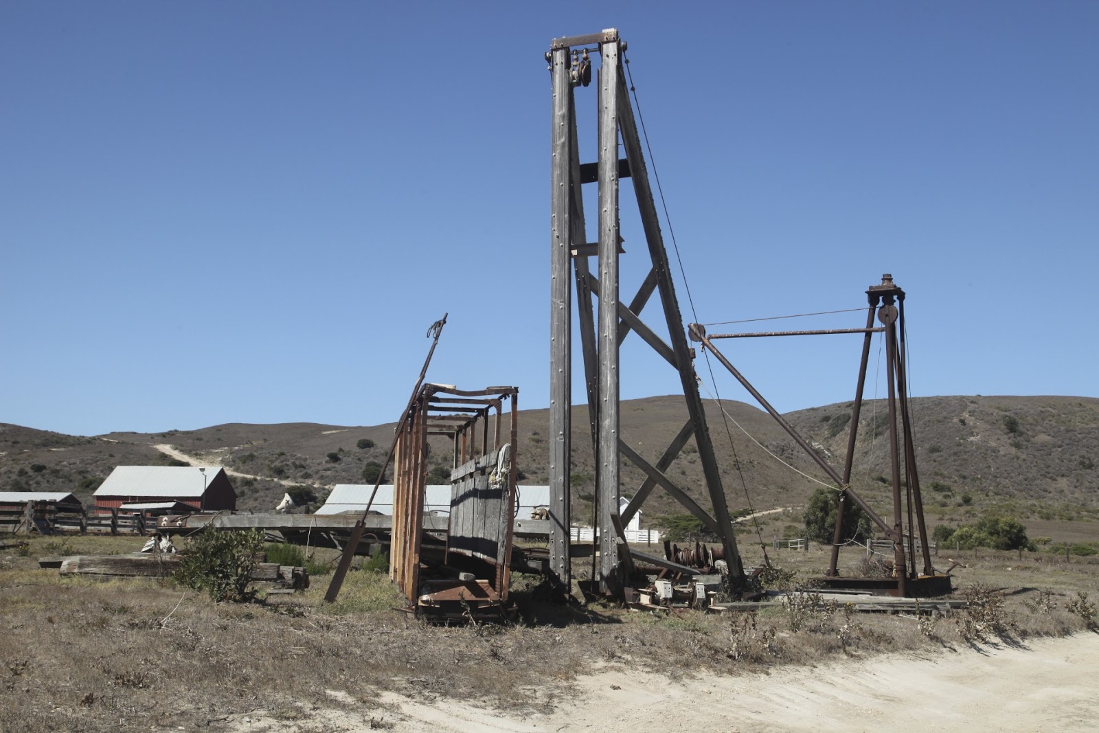

and load them onto ships in the olden days. In the picture at right you can see one of the chutes used to herd the cattle onto ships and a hoist used to lift cargo on and off of ships from the pier. Below right are more ofthe corrals which were
 very extensive in this area indicating very large herds once roamed the islands. There is also lots of old equipment like the winch below strewn about so you can let your imagination wander as you think about how it used to be out here on the islands many years ago. Included in that abandoned equipment were the three metal buoys shown below as well as piles of heavy rope and cables all around. It was a spectacular hike along the Cherry Canyon Trail on this rugged, protected
Island. As we hiked along the trail I climbed
very extensive in this area indicating very large herds once roamed the islands. There is also lots of old equipment like the winch below strewn about so you can let your imagination wander as you think about how it used to be out here on the islands many years ago. Included in that abandoned equipment were the three metal buoys shown below as well as piles of heavy rope and cables all around. It was a spectacular hike along the Cherry Canyon Trail on this rugged, protected
Island. As we hiked along the trail I climbed 
 up on the fence (inset right) and took a picture of Chaz taking a picture through the fence (below) of something in the trees I couldn't see. When I crawled down off the fence and asked Chaz what he was taking a picture of, all the while hoping it was an Island Fox, which is endemic to the island—he just pointed to the old style outhouse in the inset picture at left. Oh well, I guess outhouses are a part of the past just like all the other stuff we saw along the trail. As we hiked along the beginning part of the trail, we saw this house
 (below right) with the very interesting tree formation and the building with a very large solar panel array. The wind is clearly predominantly from the NW as the trees below are bent over towards the SE. I had read in some
  literature I had about the Water Canyon Marsh area where
 the Water Canyon creek goes into Bechers Bay. The hike I had laid out for us went along the Cherry Canyon Trail up on the ridge to give us a really good view of Becher's Bay and then came out right at the marshes at the end of Water Canyon in the vicinity of the number "2" on the map above. As it turns out, we missed the turn that would have taken us up Cherry Canyon and then onto the Cherry Canyon Trail and before we noticed that we had missed that turn we were walking along the dirt airport runway so we decided to take the hike in reverse and just continue
  on down the fire road to the marshes and then take the Cherry Canyon trail on the way back. On the way we saw cormorants, some of the biggest crows I've ever seen (see right), sea gulls, and lots of up and down
between ridges and gullies. The fire road
on down the fire road to the marshes and then take the Cherry Canyon trail on the way back. On the way we saw cormorants, some of the biggest crows I've ever seen (see right), sea gulls, and lots of up and down
between ridges and gullies. The fire road  leading down to the marshes past the airport was steep (see
  left) and basically dead ends at the marshes at the bottom of the hill. The trail skirts around the left side of the marsh as you can see in the picture at right and leads out to the beach
 (below right). We saw fox tracks (left) and lots of fox scat, but no foxes. You could hike along the beach if you wanted to, all the way back to the
 pier where we had just come from, but we wanted to hike up on the ridge overlooking the bay and along Cherry Canyon Trail. So, after looking for critters on the beach and in the marsh, we hiked back up the fire road to pick up the east end of the Cherry Canyon Trail. As we hiked back through the marsh, I told Chaz about all the survival benefits of the cattails (left), but we
  decided to stick with Jay's outstanding cooking instead of dining on cattail roots. As we got back up to where the fire road meets the airfield runway, Cherry Canyon Trail veered off to the left (west) and started to climb up the ridge. As soon as we got about halfway up the ridge we could see the campground that is shown by number "1" on the map above.
  Here's a picture of the campground and we met a couple of people coming out of it on their way back to the pier to be picked up by the Island Packers boat that comes out
  to the Island a couple times a day. Chaz took the opportunity to photograph the prickly pear cactus (see right)
  and managed to get this closeup (above left) for the picture file. From our vantage point on top of the ridge, we could see all the way to Skunk Point on the SE corner of Santa Rosa Island (see right) and we could see all the way to the pier to the north where Escape was anchored (see below left). There isn't a lot of vegetation up on top of the ridge although during the rainy season, I'm sure it is really beautifully green as it was on Santa Cruz when I was there in April. It was about 85˚ F with a nice breeze so it was an easy pleasant hike with a lot of good story telling
 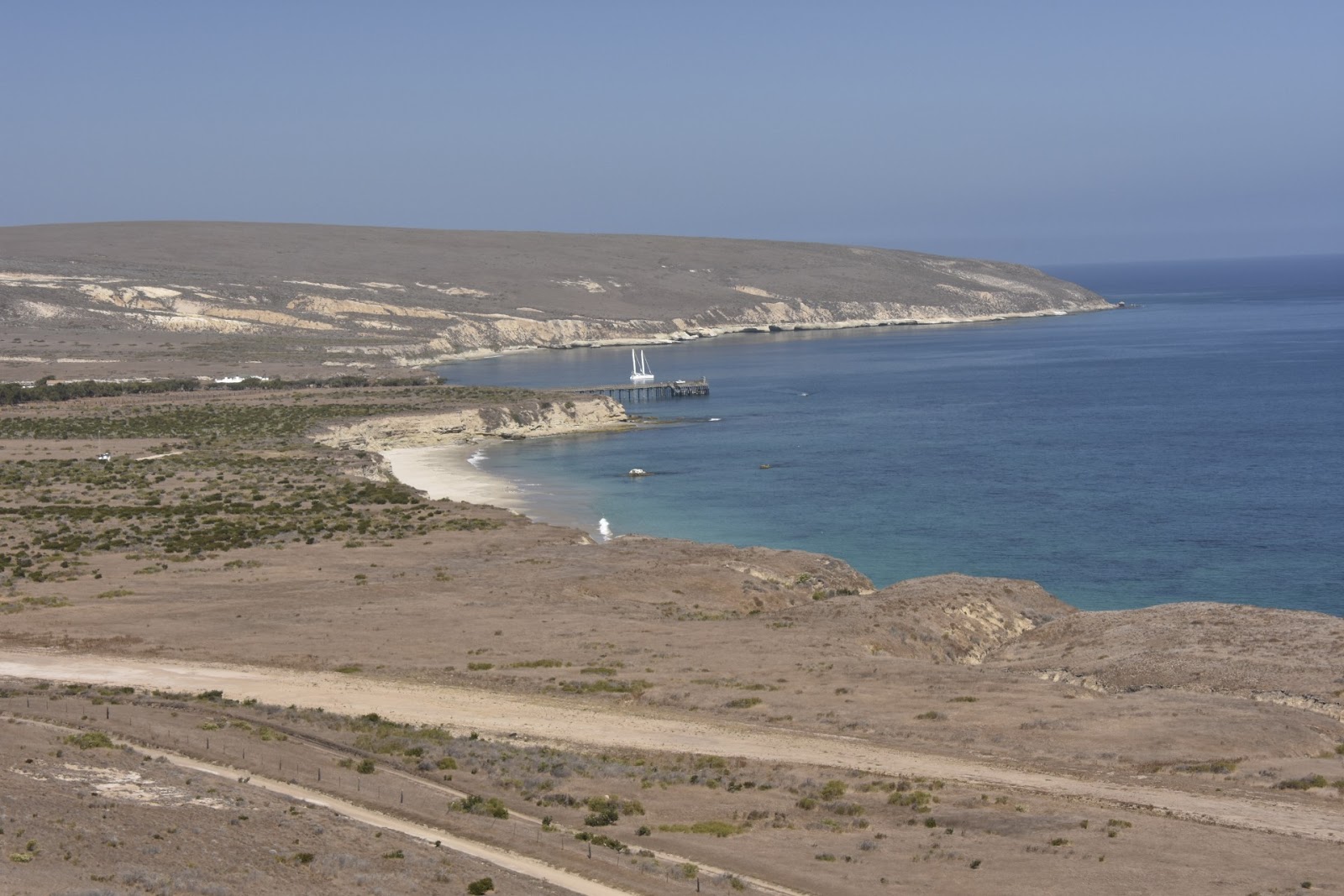 and
experience sharing between me and Chaz. In the meantime, Jay was taking Seamus, his
"red nosed pit bull" all around the harbor on the inflatable paddle board and the Dux
Duxling dinghy with a 20 hp outboard motor. As we dropped down into Cherry Canyon there was more vegetation and even some big oak trees, but there was no water in the stream bed (see below). Further down the trail the trail flattened out and turned back toward the ocean along a wash and joins the fire road where Cherry
and
experience sharing between me and Chaz. In the meantime, Jay was taking Seamus, his
"red nosed pit bull" all around the harbor on the inflatable paddle board and the Dux
Duxling dinghy with a 20 hp outboard motor. As we dropped down into Cherry Canyon there was more vegetation and even some big oak trees, but there was no water in the stream bed (see below). Further down the trail the trail flattened out and turned back toward the ocean along a wash and joins the fire road where Cherry 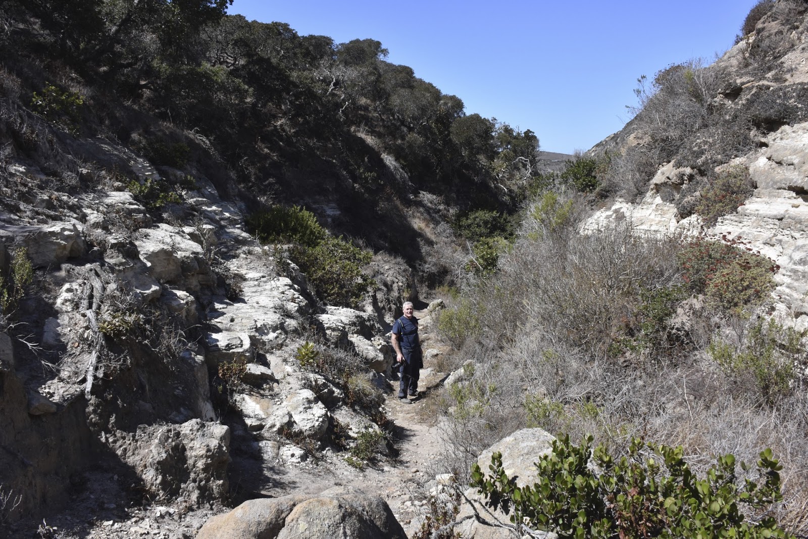
 and Windmill Canyons come together. Below is a picture of me standing above that wash and below that is a picture of Chaz sitting in one of the many dug out areas along the wash where one could take shelter if necessary or just sit for a while out of the sun. As we approached the pier, we called Jay on the VHF radio and asked him to come pick us up. He arrived about the same time we reached the pier and started down the ladder. The two hikers we had met coming from the campground were also there and looked like they would have much
rather gone with us to Escape than to wait on the pier for the Island Packers to come get them. We got back to Escape about 2 PM, weighed anchor and set course for the SW corner of Santa Cruz Island. The winds were 12 to 17 knots from the stern so we sailed wing-on-wing (see below) most of the way at 6 to 7 knots. We arrived at Willows Anchorage at 1649 hours and anchored in about 15 feet of water with lots of seaweed around. Willows Anchorage is a very
 striking location with a bold cliff on the west side and two large pinnacle rocks on the east. Here's a picture of the anchorage over the bow of Escape and a video of our anchorage at Willows: https://youtu.be/SmJkuEGGqK8.
 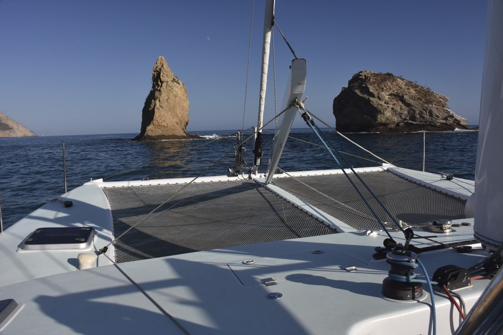 After we got the anchor set, Jay took Séamus for a paddle board ride. It's a good way for us to do a double check on our anchor because we usually anchor in only 10 to 15 feet of water since Escape only has a 3.5 foot draft. Consequently, Jay can usually see our anchor from the surface and see if it is set good. Séamus loves to go on the paddle board or in the dinghy so you have to be careful when you're putting one of those two
devices in the water because he may knock you in the water trying to get on board himself. As we followed the southern coast of Santa Cruz on our way to Willows Anchorage we passed many anchored
fishing boats of various sizes, some with nets and launches, all of which
appeared to be waiting for night before commencing active fishing. As the sun went down we could see their lights still out in the bay waiting to deploy their nets. I believe some of the boats were after squid

 because they had huge light arrays on a scaffold frame above the boat to shine down into the water to draw the squid to the surface. For dinner, Jay prepared a rich Cesar salad, clam chowder, with homemade cheese croutons and
washed down with a Firestone Walker 805 beer. Conversation took some
diversions on yacht design, cat & monohull differences in terms of the fun
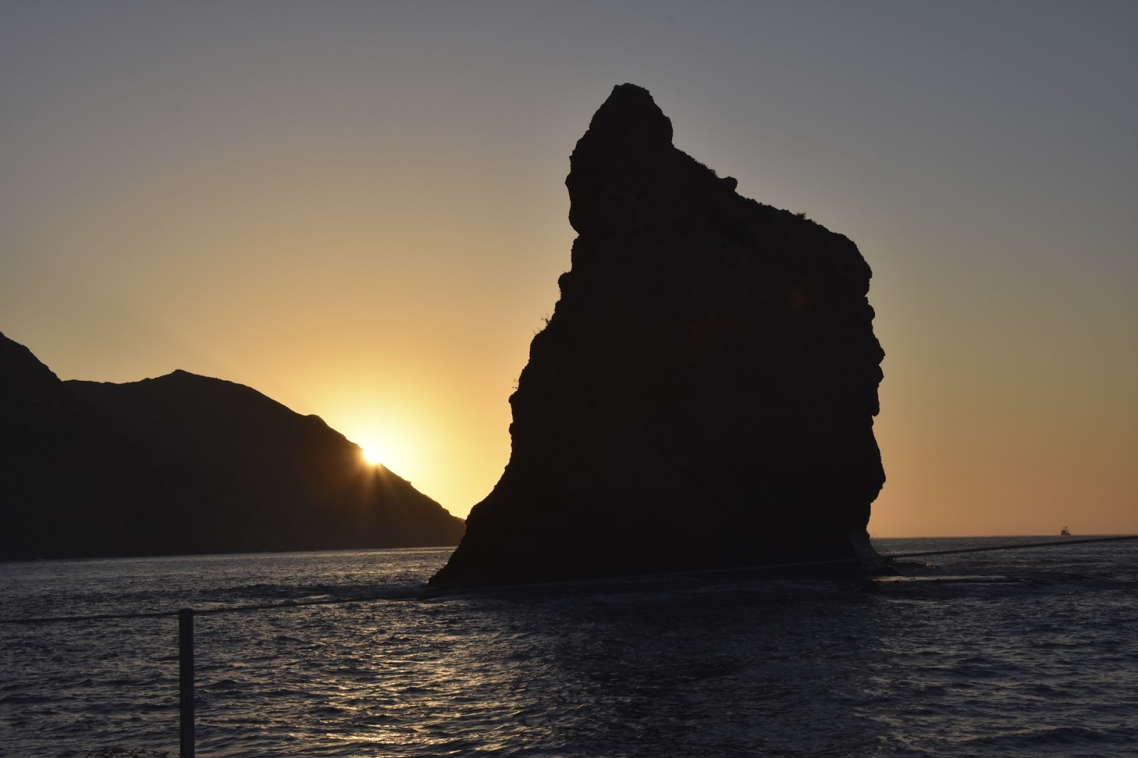
of sailing and physics of hull drag as discussed in Marchaj's book Sailing Theory and Practice. The morning on Thursday, 24 September 2015 started with this spectacular sunrise at Willows Anchorage and you can see a video of it at: https://youtu.be/HiX3zAnuKpE. Breakfast included eggs over medium with a slice of cheddar laid on top and then flipped and cooked until it was kind of like a cheese crepe on top of the egg,
left-over sausage, OJ, coffee, & toast. When we hauled up the anchor, it had this huge ball of seaweed on it that we had to cut off with a metal scraper we found below the docks when we had the boat in La Paz, Mexico. Since there wasn't
because they had huge light arrays on a scaffold frame above the boat to shine down into the water to draw the squid to the surface. For dinner, Jay prepared a rich Cesar salad, clam chowder, with homemade cheese croutons and
washed down with a Firestone Walker 805 beer. Conversation took some
diversions on yacht design, cat & monohull differences in terms of the fun
of sailing and physics of hull drag as discussed in Marchaj's book Sailing Theory and Practice. The morning on Thursday, 24 September 2015 started with this spectacular sunrise at Willows Anchorage and you can see a video of it at: https://youtu.be/HiX3zAnuKpE. Breakfast included eggs over medium with a slice of cheddar laid on top and then flipped and cooked until it was kind of like a cheese crepe on top of the egg,
left-over sausage, OJ, coffee, & toast. When we hauled up the anchor, it had this huge ball of seaweed on it that we had to cut off with a metal scraper we found below the docks when we had the boat in La Paz, Mexico. Since there wasn't
 much wind, Séamus assumed his normal watch position and we motored along the
southern shore of Santa Cruz, poking into Coches Prietos Harbor, passed by YellowBanks, and Smugglers Cove on the east end of the island and then around San Pedro Point at
much wind, Séamus assumed his normal watch position and we motored along the
southern shore of Santa Cruz, poking into Coches Prietos Harbor, passed by YellowBanks, and Smugglers Cove on the east end of the island and then around San Pedro Point at

As we passed along the south shore of Santa Cruz we saw many more fishing boats anchored there such as the Pacific Predator shown in the picture to the left. This was the most fishing boats I've seen in one spot since I've been exploring the Channel Islands so there must be some influx of fish that they're after. As we passed by Yellow Banks and Smuggler's Cove, Chaz took the wheel below and steered in close to shore so he could get a better look at some of the places where we like to anchor when we come out for a

day or two. Both Yellow Banks and Smuggler's are nice anchorages, but they often have large swells that make it difficult to get ashore. Scorpion has a pier and a rocky beach where you can land. The Pier is not for private dinghies but is reserved for tour boats such as those used by the Island Packers and the Park Service Boats. There was an Island Packers boat tied up to the buoy near the pier when we anchored there but it was not tied to the dock at the time. It was about noon by the

 time we anchored at Scorpion Anchorage and the beaches there and the swells were such that we could have probably
 landed the dinghy on the beach, but Chaz and I wanted to go hiking and didn't want to get our feet wet so we had Jay take us to the pier so we could just climb up the ladder and get started on our hike. Séamus was beside himself when he saw me putting on my hiking boots and Camelback because he knows when I do
that at home, it means he's going for a hike. So, Jay had to console him with a head massage (above right) and let him take a short nap with his blanket and pillow. As soon as we climbed up onto the dock, we were met by a park ranger and a park tour guide. They were very friendly and were anxious to tell us about what the island has to offer and what there was to see near Scorpion Anchorage. I was wearing one of my Search and Rescue T-Shirts and they immediately asked if I was on the team and

I told them I had recently retired from SAR Team 3 and that we had made a recovery or two out on the island and that the team was currently planning a joint training session
 out at the island. They were very interested
  in that. Near the pier there are lots of old pieces of machinery such as the ones shown at left and this blacksmith shop (right) where Chaz is standing that has a very interesting doorway made of many different types of
  tongs and pliers welded together. Below left is a picture of the bay and the pebbly beach where we could have landed if we hadn't gone to the pier. Escape is seen at anchor in the distance. The plan for Chaz and I was to climb up to the North Bluff Trail and get a look down in to Potato Harbor which is a delightful little bay with excellent protection from southerly or easterly winds, but not so much if the winds or waves are from the NW. Below are a couple of pictures of Potato Harbor taken from above. It looks like it's full of seaweed so one
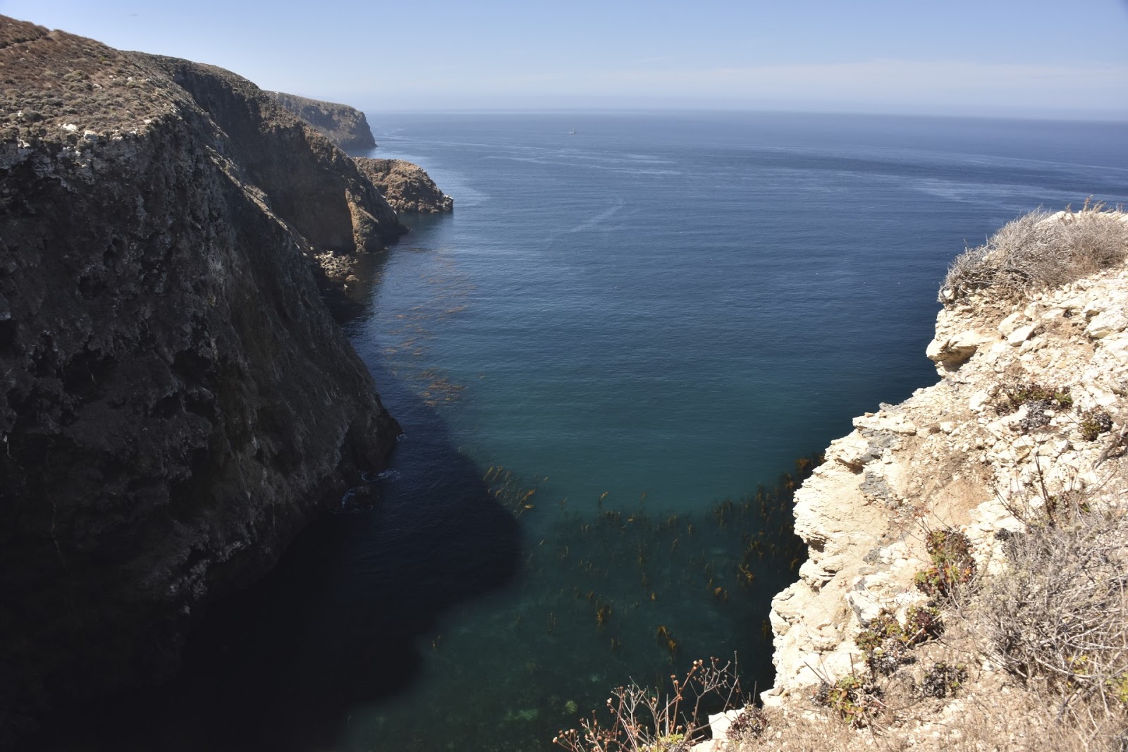
would have to be careful going in and coming out to avoid getting tangled up with lots of seaweed. I have had some trouble with these large forests of seaweed because some of the large flat leaves can get caught on the sail drives and block the intake holes for cooling water to the engine. When that happens, I have to stop, put the boat in reverse to dislodge the seaweed and then go on my way. It's about a 250 to 300 foot drop from the top of the ledge down to the sea and the rock is very

 crumbly so you really have to be careful not to get too close to the edge without
  safety gear on. Chaz took this picture of the waves swirling around the rock among the seaweed as we hiked along the North Bluff Trial to join up with the Cavern Point Loop Trail that would take us along the north shore of the bluff and loop back down
  to Scorpion where we could meet Jay at the dock. We saw this Geodetic Survey marker embedded in the rock near where the North Bluff Trail meets the Cavern Point Trail. The shoreline along the north side of Santa Cruz
  really is spectacular as you can see from the picture at right above. I just couldn't resist taking one more picture—they're digital and cost nothing, so what the heck, why not take one more. You never know which one will be the one you're looking for once you get them downloaded to the computer where you can see them in more detail. Here's a picture of the trail as we go along the NE ridge line on the Cavern Point Trail headed East. You can see Anacapa Island off in the haze in the distance. As you head back down towards the beach heading
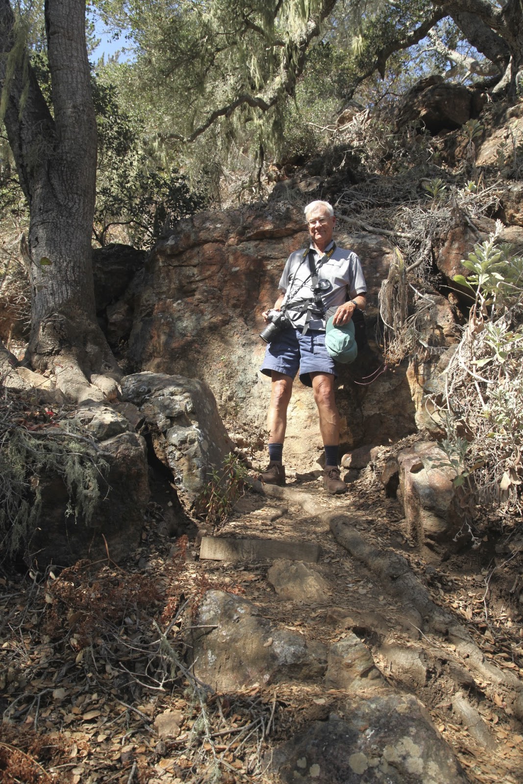
  southeast we could see Scorpion Anchorage and could see Escape sitting at anchor just beyond the Island Packer tour boat. I took this picture of Chaz at one of the turnouts along the trail. At this point we could both kind of feel that our fantastic four-day adventure was coming to an end so we were kind of dragging our feet as we shuffled on down the trail. We called Jay when we were hiking down the fire road back toward the pier when we could see Escape sitting at anchor at the end of the
road (below left). When Jay arrived at the bottom of the ladder on the side of the pier in the dinghy, he had Séamus with him and he was so excited that we almost couldn't get off the ladder into the dinghy without falling overboard. At any rate we made it safely back to Escape and since the wind was about 8 knots, we motor sailed back to home port at 6-7 kts on a broad reach in sunny clear air, arriving about 5 PM. After clean up and shutdown we drove in tandem to Thousand Oaks and were joined by Elaine and Heather before going out to

dinner at a local restaurant to celebrate our fantastic adventure.